Lines around the world
Look at a globe or a map of the world. Have you ever wondered why there
are so many crisscross lines? There are no lines on the earth, so why
put lines on globes and maps?
The lines are put there to make it easy to find places. The lines are
like city streets. When two friends meet at the corner of Oak and Main,
they are meeting where two streets cross. On a globe or map, the
east-west lines cross the north-south lines just like streets. Every
place on earth can be found at or near where two of the lines cross.
The east-west lines measure distance north or south of the equator. This
is called latitude. Because the lines are parallel—always the same
distance apart—we call them parallels of latitude. Latitude is
measured in units called degrees. The symbol after each number is a
degree sign. Latitude is always given as so many degrees north or south
of the equator.
The north-south lines measure degrees east and west. We call this
longitude. The lines are called meridians. The starting point is a line
called the prime meridian. This line passes through Great Britain.
Longitude is given as so many degrees east or west of this line.
Latitude and longitude is one way to find a place. Another way is used
on small area maps, such as road maps. Numbers and letters are around
the edges of a road map. Lines drawn from the letters cross other lines
drawn from the numbers. Such a map will have a list of the places shown.
After each place name, there is a symbol, such as C4. Look at the map
and you will find the place near where the lines C and 4 cross.
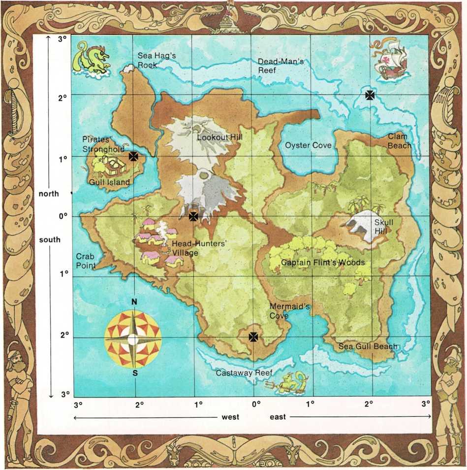
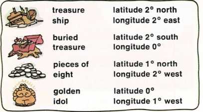
Treasure Hunt
Find the four treasures by using the latitude and longitude given for
each one. Work out for yourself the latitude and longitude of places
shown on the map.