How far is it?
A map may be millions of times smaller than the real land it pictures.
So how can you find out how far it is from one place to another?
To find out, you use a “measuring stick” called a scale. Scale means
that a certain distance on a map stands for an actual distance on the
earth’s surface.
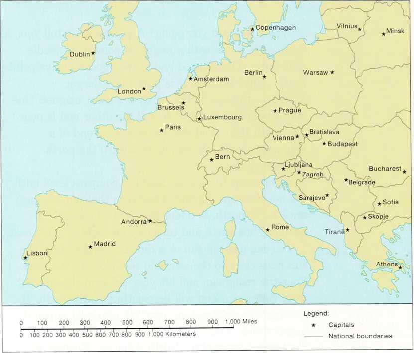
Map scales are shown in three different ways. One kind of scale is a
straight line on which distances are marked. Each mark stands for a
certain number of miles or kilometers. To find the actual distance
between two places, measure the distance between them on the map. To do
this, line up the two places on the edge of a piece of paper. Make a
mark for each place. Then, move the paper down to the scale. Line up one
mark with the 0 on the scale and read the distance opposite the other
mark.
Another kind of scale says that so many inches or centimeters equal so
many miles or kilometers. For example, the scale might read: 1 inch = 10
miles, or perhaps 1 centimeter = 20 kilometers. With a ruler, measure
the distance between two places on the map. Then, multiply inches by 10
to get miles or centimeters by 20 to get kilometers.
Still another kind of scale is shown as a fraction. If the map has
1/50,000 as its scale, then 1 unit of measurement on the map is 50,000
times larger on the surface of the earth. With this kind of scale, 1
inch or 1 centimeter on the map would equal 50,000 inches or centimeters
on the earth.

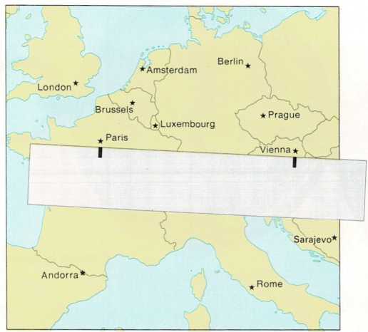
measuring distance on a map
Find the distance from Paris to Vienna by using a piece of paper and the
scale from the map below. About how far is it from Berlin to Madrid, or
from Dublin to Athens?


